Singaporean Nautical Charts
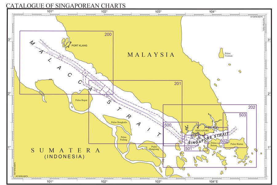
The Hydrographic Division of the Maritime and Port Authority of Singapore (MPA) publishes and maintains nautical charts covering the Straits of Malacca and Singapore from One Fathom Bank to Horsburgh Lighthouse.
There are 9 Singaporean Nautical Charts. All are based on the World Geodetic System 84 Datum (WGS 84) and conform to the specifications of the International Hydrographic Organization (IHO) for international charts.
The list of latest edition Singaporean Nautical Charts can be found in our monthly Singaporean Notices to Mariners. The 200 and 500 series Singaporean Nautical Charts are available through a print-on-demand (POD) service. These charts, updated with the latest Notices to Mariners before they are printed and sold to customers, are the most up-to-date paper charts for navigational use. The convenience of POD charts means that customers need not make numerous hand corrections to the nautical charts before use. This allows for a much clearer presentation of updated information than offset-printed charts with hand corrections, especially in cases where there are several overlapping corrections over existing information.
List of Singaporean Nautical Charts
Chart No. | Chart Title and Limit | Scale 1: | Remarks |
|---|---|---|---|
1 | Symbols Abbreviations Terms Used and S-57 Objects | - | Chart 1 is now available online |
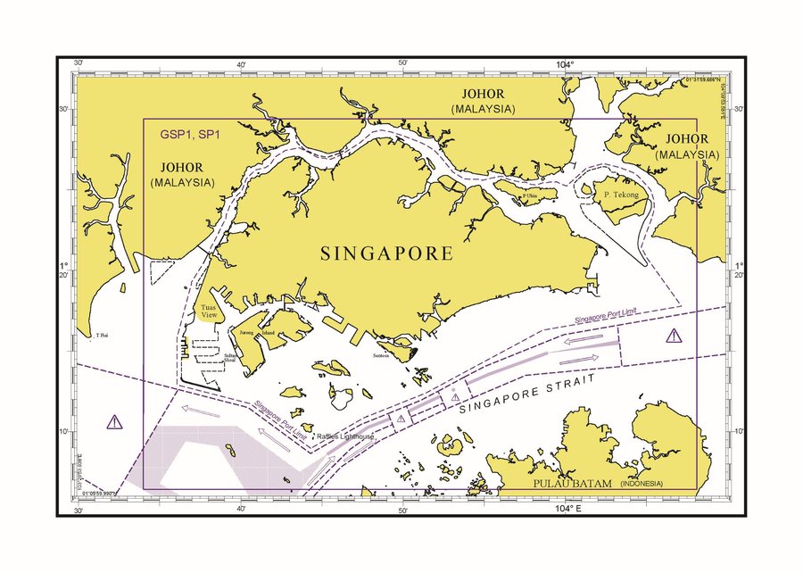
SP1 | Anchorages and Aids to Navigation 1°06.43'N 1° 29.40'N 103°34.00'E 104°08.10'E | 65000 | Print-on-demand |
GSP1 | Anchorages and Aids to Navigation (with area reference) 1°06.43'N 1°29.40'N 103°34.00'E 104°08.10'E | 65000 | Print-on-demand |
200 | Malacca Strait – Port Klang to Tanjong Keling 2 °01.48'N 3°12.00'N 100°26.36'E 102°09.91'E | 200000 | Print-on-demand |
201 | Malacca Strait - Tanjung Keling to Western Entrance of Singapore Strait 1°06.43'N 2°17.00'N 101°42.91'E 103°26.45'E | 200000 | Print-on- demand |
202 | Singapore Strait 0°40.00'N 1°50.00'N 103°05.34'E 104°48.89'E | 200000 | Print-on- demand |
500 | Malacca and Singapore Straits – Pulau Pisang to Raffles Lighthouse 1°04.05'N 1°30.50'N 103°05.80'E 103°44.61'E | 75000 | Print-on- demand |
501 | Singapore Strait – Western Part 0°58.37'N 1°16.00'N 103°29.17'E 103°55.05'E | 50000 | Print-on- demand |
502 | Singapore Strait – Eastern Part 1°07.00'N 1°24.61'N 103°51.43'E 104°17.31'E | 50000 | Print-on-demand |
503 | South China Sea – Eastern Approaches and Entrance to Singapore Strait 1°02.00'N 1°41.06'N 104°11.89'E 104°38.17'E | 75000 | Print-on-de |


These Singaporean Nautical Charts can be purchased from the following chart distributors:
E.W. Liner Charts & Publications Pte Ltd
100 Pasir Panjang Road
#05-10
Singapore 118518
Tel: (65) 6323 0773
Fax: (65) 6323 0775
Email: sales@ewliner.com
Website: http://www.ewliner.com
Novaco Navigation Pte Ltd
3791 Jalan Bukit Merah
#05-07 E-Centre @ Redhill
Singapore 159471
Tel: (65) 3163 3253
Email: support@novaco.co.uk
Website: https://novaco.co.uk
Weilbach Singapore Pte Ltd
237 Alexandra Road
#06-18 The Alexcier
Singapore 159929
Tel: (65) 6273 0833
Email: sales@weilbach.com
Website: www.weilbach.com
